Now Also operating from our new yard in Alice Springs. Our address is 3/31 Elder Street Ciccone 0870.


Does Before You Dig Australia Show the Exact Location of Underground Services?
August 20, 2026
Before starting excavation or directional drilling, civil contractors need to lodge a Before You Dig Australia (BYDA) enquiry and review the plans provided. However, these plans do not necessarily show the exact location of every underground service. JSM Civil recognises that BYDA information is an important planning tool, but its accuracy can vary depending on the records and information supplied by individual asset owners.
Knowing what BYDA plans show and where their limitations lie is essential for managing underground service risks. Plans may indicate the general alignment of services without confirming their exact position or depth, particularly where records are old or incomplete.
BYDA plans should therefore be treated as a starting point, with appropriate on-site locating and verification used where required. Service locating, potholing and non-destructive digging can help confirm the presence of existing infrastructure before excavation or drilling begins, reducing the risk of service strikes, delays and costly project changes.
Before You Dig Australia (BYDA) provides plans and information about underground services to help contractors plan excavation and civil works safely. BYDA plans are indicative only and should not be treated as precise dig-to coordinates or a guarantee of an asset's exact location or depth. The information comes from individual asset owners, so the level of detail and accuracy can vary between services.
A BYDA enquiry may identify underground infrastructure such as:
Plans may show the approximate alignment of a service, recorded depth, pipe or cable details, easements and other relevant information. They can also include conditions like minimum clearances, requirements for non-destructive digging, notification procedures or restrictions on excavation near assets.
The accuracy of the information depends on the quality and age of the asset owner's records. Some services may be mapped using older records or broad corridor information, while depth details may be unavailable or based on historical installation data. Accuracy notes and warnings included on individual plans should therefore be reviewed before work begins.
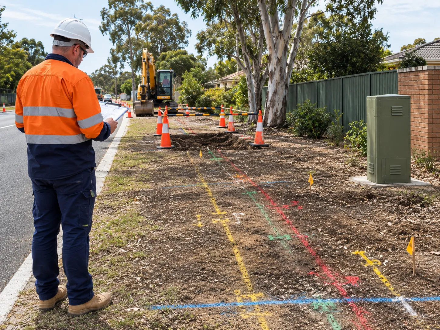
When BYDA plans identify underground services within or near the proposed work area, contractors should not rely on the mapped alignment alone. The plans should first be compared with the proposed excavation or directional drilling path to identify potential conflicts and determine what further verification is required.
A practical approach is to:
If a service shown on the plans cannot be located confidently, work should not proceed on the assumption that the recorded position is correct. The relevant asset owner, competent service locator or project supervisor may need to be consulted to determine the appropriate verification method.
BYDA plans are an important planning tool, but they should not be treated as a precise map of underground services. They show the recorded or approximate alignment of an asset, while its actual position and depth can vary due to the age and quality of records, changes to the site and limitations in how the information was originally captured.
Factors affecting accuracy are:
Some plans also specify positional accuracy limits or state that information is provided for indication only. Where depth is shown, it should be treated as indicative unless independently verified onsite.
BYDA plans provide an indication of where underground services may be located, but they do not confirm their exact position or depth. Proper service locating involves reviewing the available information, using suitable detection equipment and physically exposing critical services where necessary.
Each asset owner's plan should be checked for its scale, accuracy notes, warnings and excavation requirements. Services that could conflict with the proposed works can then be identified and their approximate alignments marked on the ground.
The marked position remains an initial guide. Services may differ from their recorded location because of outdated plans, ground movement, previous works or incomplete records.
Electronic locating can help trace services more accurately across the work area. Depending on the asset and site conditions, this may involve electromagnetic locating, ground penetrating radar (GPR) or other suitable detection methods.
These methods can establish a likely alignment and, in some circumstances, an indicative depth. However, readings can be affected by surrounding services, reinforced concrete, soil conditions and other sources of interference, so they should be interpreted appropriately.
Where a service is within or close to the proposed excavation or directional drilling path, its position may need to be confirmed through potholing or non-destructive digging. Hydro excavation can expose the asset while reducing the risk of damaging it during the locating process.
Physical exposure can help confirm:
Verified locations should then be clearly marked and recorded so they can be incorporated into the excavation or drilling plan.
BYDA provides important information about underground assets, but it does not physically locate or verify them. The contractor or person undertaking excavation or drilling has an important responsibility to identify and manage underground essential services, subject to the project's arrangements, asset owner requirements and applicable WHS obligations.
Obtaining a response is therefore only the starting point. The information needs to be reviewed, potential conflicts identified and appropriate locating or physical verification arranged before work proceeds.
BYDA acts as a central service for requesting plans and information from participating asset owners. Each asset owner provides its own records, warnings and excavation requirements, which can vary in accuracy and detail. Contractors should therefore review the conditions attached to each plan rather than assuming that one set of requirements applies to every service.
The person performing the work should also consider services that may not appear on plans. Private, undocumented or unrecorded infrastructure may still be present on older or previously developed sites.
Asset owners may impose additional controls, including minimum clearances, permits, notifications, supervision or physical exposure of their assets. These requirements should be incorporated into the project's work method and planning.
Where a service cannot be confidently located or its position remains uncertain, work should pause until an appropriate verification method has been determined.
Hydro excavation is a non-destructive digging method that can be used when underground services need to be exposed before mechanical excavation or drilling. It can be useful where BYDA plans and locating equipment indicate a potential service conflict, but the asset's exact position or depth needs to be confirmed.
Hydro excavation may be appropriate when:
Hydro excavation uses pressurised water to loosen surrounding soil and a vacuum system to remove it. This allows the area around a buried asset to be exposed without relying on mechanical excavation equipment directly against the service. This type of non-destructive digging allows the area around a buried asset to be exposed without relying on mechanical excavation equipment directly against the service.
Once exposed, the service's position, depth, size and configuration can be recorded and incorporated into the excavation or drilling plan. This can be valuable where records are outdated or several utilities are located close together.
BYDA plans can help identify likely service locations and determine where physical verification may be needed. Test-hole locations can then be selected at critical points, such as proposed crossings or areas where the bore passes close to existing infrastructure.
The confirmed information can be used to refine the work method or directional drilling profile and maintain the separation required from existing services. Where an asset owner specifies non-destructive digging, those requirements should be followed before mechanical excavation proceeds.
.webp)
Accurate service locating gives drilling crews a clearer understanding of existing underground infrastructure before a bore begins. This information is particularly important when using directional drilling technology, where the bore must follow a controlled path around existing underground infrastructure. While BYDA plans indicate the likely location of services, on-site locating and physical verification provide more reliable information about their actual position and depth.
This is vital in congested areas where multiple utilities share the same corridor. Confirming services early allows potential conflicts to be identified before drilling and allows the team to adjust the bore profile, entry and exit points or drilling method.
Accurate verification helps to:
If a service shown on a plan cannot be located confidently, drilling should not proceed on the assumption that the mapped position is correct. Further investigation or consultation with the relevant asset owner may be necessary.
Before directional drilling begins, the drilling team should have verified information about underground services along and near the proposed bore path. Plans provide the starting point, but critical details should be checked against actual site conditions so the bore can be designed around existing infrastructure.
Confirm the following information:
If a service shown on the BYDA plans cannot be confidently located, further locating, physical verification or consultation with the relevant asset owner may be required before the bore proceeds.
Accurate service verification is essential before directional drilling because plans provide indicative information rather than a guaranteed exact position or depth. Confirming underground services onsite gives the drilling team a stronger basis for designing the bore around existing infrastructure.
This is important in congested corridors where gas, electricity, water, sewer and telecommunications services may be located close together. Even a relatively small difference between a mapped and actual position can affect the planned bore path.
Effective verification can help:
Where necessary, electronic locating, potholing or hydro excavation can be used to confirm critical services before drilling begins. If an asset cannot be confidently located, work should not proceed based solely on the position shown on a BYDA plan.
Before You Dig Australia provides an essential starting point for excavation and civil works, but its plans should not be treated as an exact map of underground services. JSM Civil understands that BYDA information needs to be considered alongside on-site locating, risk assessment and appropriate verification methods.
By combining BYDA plans with service locating, potholing and non-destructive digging, contractors can make better-informed decisions before work begins. This approach helps reduce the risk of service strikes, protect workers and the public, minimise costly delays and support safer, more efficient directional drilling and civil construction projects.


